 The Yukon
Beaver Creek sits right at the Alaska border, the last Canadian community on the Alaska Highway before you cross into the United States. It's a small, practical highway town built around fuel, food, and a bed for the night rather than a destination in its own right, though its place in Alaska Highway history gives it real weight.
Historically, Beaver Creek is where the Alaska Highway's final gap closed on October 25, 1942, when a Black soldier from the 97th Engineers and a white soldier from the 18th Engineers, working from opposite ends, met and shook hands, an event now widely credited as one of the catalysts for the desegregation of the US military in 1948. It's a separate moment from the one at Contact Creek a month earlier, further south at the BC-Yukon border, where crews building north from Dawson Creek met crews working out of Whitehorse. Beaver Creek was the final link, the one that actually finished the highway.
Where to stay in Beaver Creek
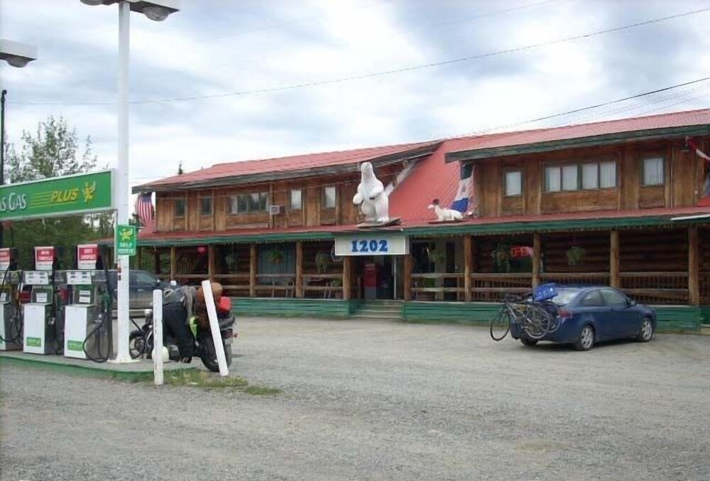
The village's own accommodation options, 1202 Motor Inn, Ida's Motel & Restaurant, and Beaver Creek RV Park & Motel, cover fuel-stop basics. Discovery Yukon Lodgings, about 48 km away in Koidern, is a further option if you're passing through that stretch of highway instead.
Stays in Beaver Creek
Real, reviewed rooms — booked at the same live rate through app.impt.io, one tonne of carbon removed per stay.
Things to do in Beaver Creek
Fuel and cinnamon rolls at Buckshot Betty’s
On the Alaska Highway in the middle of Beaver Creek. Cafeteria-style diner, oversized baked goods, and a gas pump out front. Not gourmet, but exactly what you want after 6 hours of driving. Cash and card. Open long hours in summer, shorter in winter.
Alaska border sign photo
30 km west on the Alaska Highway from Beaver Creek. The Canada-US border sign and the small park around it. Bring passport if you’re actually crossing. Otherwise, photo and turn back. Note: the US customs post is 30 km further west at Border City — you can’t just tap the sign and leave without paperwork if you cross.
White River First Nation Cultural Centre
Signed off the Alaska Highway in Beaver Creek. Small display of Upper Tanana Athapaskan history, language, and artwork. Hours seasonal and variable — phone ahead or check the door. Free or small donation.
Northern lights from the highway pullouts
Any pullout west of Beaver Creek toward the border. Extremely dark skies, no light pollution for 100 km in any direction. September, October, February, March best. Bring warm clothes and a red-light headlamp. Do not park on the highway itself — full pullout, hazards on.
Getting around & the essentials
Beaver Creek is on the Alaska Highway, the last fuel and services stop on the Canadian side before the US border. Fill up here regardless of your onward plans; services thin out quickly in both directions from this point.
Beaver Creek — Questions, answered
Do I need to stop in Beaver Creek if I’m driving to Alaska?
Yes — fuel up, use the bathroom, get food. From Beaver Creek to Tok, Alaska is 180 km of remote highway with limited services. Buckshot Betty’s is the last real meal until Tok. Also, if you arrive at the border after Canadian customs hours, plan accordingly.
Can I see the aurora from Beaver Creek?
Yes, exceptionally well. Very dark skies, wide open horizon to the north, and you can drive 5 minutes out of town to any pullout. The catch is winter temperatures — -35°C is common in January and February. Warm car, warm clothes, warm accommodation waiting for you.
Nearby areas
Every stay booked through The Yukon funds one verified tonne of carbon removal — same room, same price, the climate action already built into checkout.
You're not charged more and the hotel isn't paid less. It's just what happens when you tap Reserve.